Locust surveillance starts in Victoria’s Wimmera region
Locust surveillance means people digging in dirt for eggs laid months ago, not watching the sky for swarms.
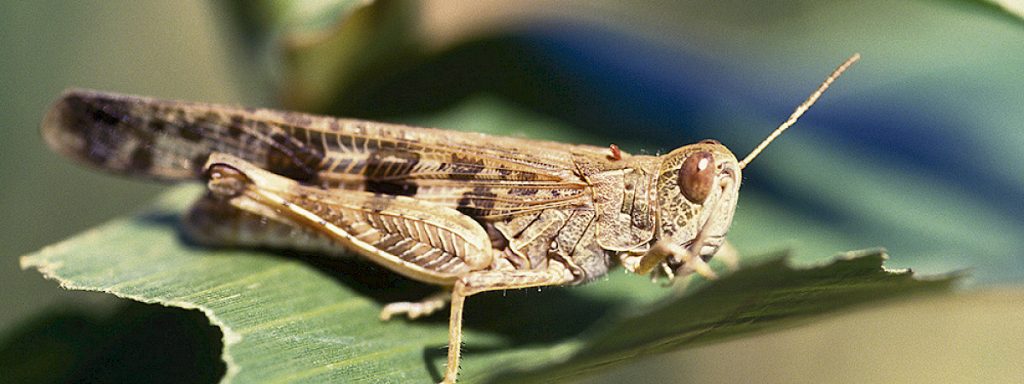
The locust surveillance now under way across the Wimmera has almost nothing to do with locusts themselves. At this stage, officers are not watching the sky for swarms or counting hopping nymphs in a paddock. They are kneeling in dirt, digging small test pits into firm, bare or lightly vegetated soil, looking for clusters of egg pods that female locusts laid back in autumn. The insects that matter most right now have no wings, no legs that move, and will not exist as living creatures for weeks or months yet. That is the part of “surveillance” that rarely makes it past the headline.
- Surveillance at this stage means mapping egg beds in soil, not spotting live locusts or swarms
- No spraying decision will be made until egg beds are confirmed and hatching timing is better understood
- Wimmera’s risk is rated lower than the Mallee’s, but conditions can change block by block
- Landholders are the first line of reporting, and control costs are shared differently depending on where land sits
What surveillance on the ground actually involves
Surveillance teams work paddock by paddock, prioritising the kind of ground female locusts prefer for egg-laying: firm, undisturbed, often sandy or sandy-loam soils with sparse groundcover, frequently along fence lines, tracks, road verges and the edges of cropped paddocks left fallow or lightly grazed. Officers dig shallow pits, sometimes no deeper than a trowel’s length, and sieve or sift the soil looking for egg pods, which resemble small frothy capsules packed with dozens of individual eggs. Where pods are found, the location is recorded, the density is estimated, and the site is flagged on a map that builds up over days and weeks into a regional picture of where hatching is likely to be heaviest.
This mapping work takes time precisely because it is manual and site-specific. There is no satellite shortcut for finding something the size of a grain of rice buried under topsoil. Once egg beds are mapped, the next phase is watching development: soil temperature and moisture through late winter and early spring heavily influence when eggs hatch and how synchronised that hatching is. A warm, damp spring tends to bring eggs on faster and more evenly, which actually makes control easier, because nymphs are easiest to treat in their early, wingless stages when they are clustered and cannot yet fly away from a problem. A patchy, cool spring can stretch hatching out over many weeks, complicating both detection and any response.
Only after hatching begins does surveillance shift to counting nymphs, assessing their density and instar stage, and judging whether numbers justify control. That decision point is still weeks away for most of the Wimmera. Nothing about egg-bed mapping triggers an automatic spray response; it simply tells authorities where to look next.
Wimmera and Mallee are not the same risk, and that is the point
For readers outside Victoria’s agricultural heartland, the Wimmera sits in the state’s west, a belt of cropping and grazing country running roughly from Ararat and Stawell in the east out toward the South Australian border, with towns like Horsham, Nhill and Warracknabeal at its centre. The Mallee lies further north and west again, a drier, sandier region stretching up toward Mildura and the Murray River. The two regions share a border and plenty of road traffic, but they do not share soil type, rainfall pattern or, crucially, locust history in the same measure.
That difference in soil and recent breeding conditions is exactly why risk ratings differ: the Mallee’s moderate-to-high rating reflects sandier country and egg-laying conditions picked up during autumn surveys, while the Wimmera’s low-to-moderate rating reflects a less favourable but not negligible setup. Risk ratings are regional averages, though, not guarantees for any individual paddock. A Wimmera farmer with a sandy rise or a long-fallow block that matches the Mallee’s egg-laying profile could still be sitting on a hot spot inside an otherwise lower-risk shire. That is part of why on-ground surveillance matters more than the regional label attached to it.
Is this actually heading toward a plague?
It is worth separating the word “plague” from the word “surveillance,” because they describe very different stages of the same insect’s life. A plague describes a landscape-scale outbreak, with egg beds dense and widespread enough across multiple regions that hatching produces nymph bands, then swarms, capable of stripping crops and pasture over large areas and moving between properties and even states. The Wimmera’s experience during the 2010-11 outbreak, still the reference point many local farmers measure against, reached that scale after a sequence of favourable breeding seasons stacked on top of each other.
What is happening now is the stage that, in a good year, never becomes a plague at all: targeted checking of known breeding ground based on autumn surveys, done specifically so that any problem is caught and treated while it is still localised and wingless. Describing current activity as evidence of an imminent plague overstates what egg-bed mapping tells anyone. Describing it as nothing to worry about understates why authorities are out there in the first place. The honest answer sits in between: conditions are being watched closely because the ingredients for a larger problem exist in parts of the broader Mallee-Wimmera footprint, not because a plague has been declared or is considered inevitable.
Who pays, and who decides when spraying happens
Control costs in Victoria are generally split according to where the problem sits. On public land, roadsides, rail reserves and crown land, government agencies typically fund and carry out treatment once nymph densities justify it. On private land, the landholder is usually responsible for control, though government support, subsidised chemical, aerial spraying coordination or cost-sharing arrangements can be activated once an outbreak reaches a scale that justifies a coordinated regional response, as happened in past major outbreaks. At the current egg-mapping stage, no broadscale spraying program has been funded or scheduled, because there is nothing yet to spray; nymphs have not hatched. Any aerial or ground spraying decision will follow confirmed nymph counts, not egg-bed maps alone.
What Wimmera landholders should do right now
The most useful thing an individual landholder can do during this phase is report, not treat. If you notice unusual soil disturbance, small holes in bare firm ground, or adult locusts laying eggs in autumn-to-now, reporting that location helps build the regional map faster and more accurately than agency staff working alone ever could. Avoid deep cultivation or heavy disturbance of suspected egg-laying sites before they are assessed, since disturbing egg beds does not reliably kill eggs but can scatter information surveyors need. Do not apply chemical control against eggs; registered products target hatched nymphs, not eggs buried in soil, so spraying now would waste money and chemical for no benefit.
Quick tip: keep a simple written or photo record of any locust activity you see on your property, with a date and rough paddock location, even if you are not sure it is significant. That record becomes far more useful to surveillance teams, and to your own planning, than a vague memory of “locusts somewhere near the dam” weeks later when hatching begins and decisions need to move quickly.
Beyond reporting, the practical preparation worth doing now is logistical rather than chemical: know which registered locust control products you would use and have access to, understand whether your property falls inside a priority shire where coordinated response support may apply, and keep an eye on regional updates through spring as egg-bed maps are completed and hatching forecasts firm up. The next genuinely actionable moment for most Wimmera landholders will come when nymphs start appearing, not before.

Member Stories
Breeder profiles and member stories from across the Australian Wiltshire Horn community.